
You will use the Landsat 5&7 sample products made available by the USGS at http://landsat.usgs.gov/product_samples.php
The list of products used as test data is:
Landsat 5 TM
Acquired June 16, 1991: L5 TM 30-meter thermal - .tgz (175 MB)
Acquired June 27, 1995: L5 TM 30-meter thermal - .tgz (171 MB)
Landsat 7 ETM+
Acquired August 17, 1999: L7 ETM+ 30-meter thermal - .tgz (316 MB)
Acquired April 22, 2009: L7 ETM+ 30-meter thermal - .tgz (274 MB)
The application’s data pipeline activities can be defined as follows:
Use the Python NDVI package to apply the band arithmetic expression to calculate the NDVI to all Landsat products passed as references to the Sandbox catalogue.
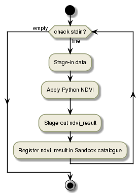
This translates into a very simple workflow containing a single processing step: py-ndvi
The simple workflow can be represented as:
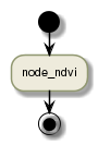
The node_ndvi is described in details in Processing nodes design
| [1] | GDAL Geospatial Data Abstraction Library |
| [2] | GDAL Geospatial Data Abstraction Library Python package |