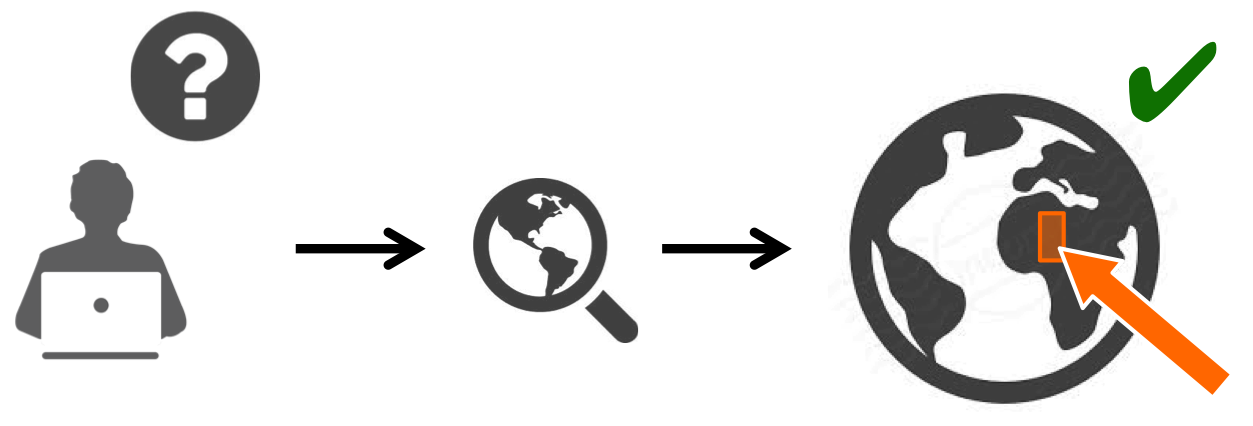
Discovery of data is made through the geobrowser.
You can search for data from a specific collection of a catalogue or from a public or private data package, look for data related to specific events, simply see amongst the proposed contextualized results, or even search within results of a processed wps job.
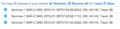
Put data in your basket and save it for later, or simply drag and drop data as a parameter of a process.
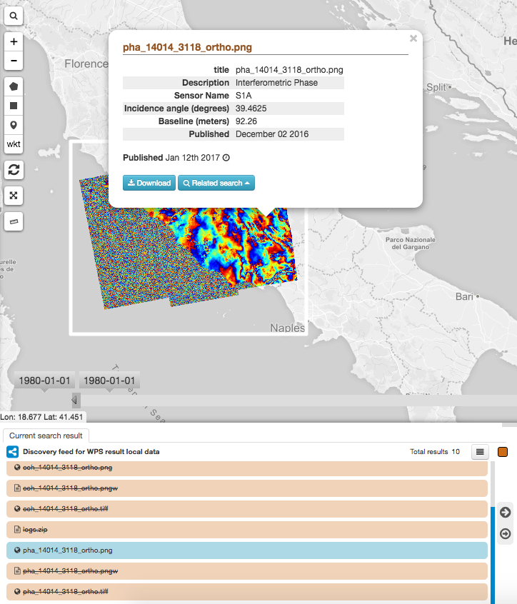
When the OWS Context describing the data contains the adequate information, the data can be visualized on the geobrowser (e.g as an image, as a time series, ...) and a popup containing metadata about the data will be displayed.
Data discovery is made through the map. To get specific data:
 to open the query tab.
Tip
in the Search Term field supported wildcards are ‘*’, which matches any character sequence (including the empty one), and ‘?’, which matches any single character.
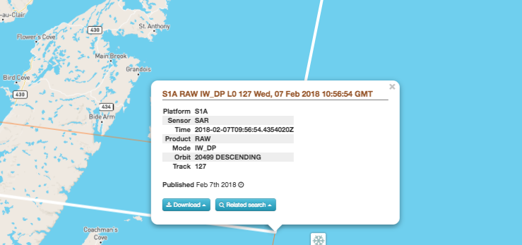
Example of Sentinel 1 popup information
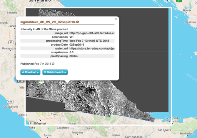
Example of process result popup information
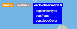
Once you have performed a search, all filters used for this search are displayed on the window, grouped by type of filter (e.g time, spatial, earth observation, ...). You can then remove one filter, remove the whole filter group or check the selected value (go over with the mouse during few seconds).
Data related to a specific context can be accessed by clicking on one of the available context on the top-right of the browser.
Currently existing contexts are:
Once clicked on a context, data automatically appear on the map.
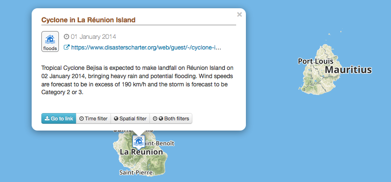
To access data related to a specific event:
To visualize results on the map:
Warning
You may need to be connected to the GEP Virtual Private Network (see Join the GEP Laboratory), in order to download the results.
Data can be selected on the map as well as on the result tab.
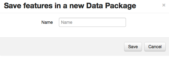
To create a new data package:
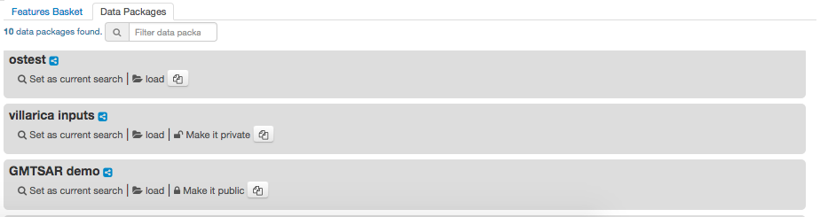
To access a previously saved data package:
To clear your current basket:
To download a data listed on the Results Table:
If the resource location points to a data gateway url (usually the name contains via Data Gateway), ex: https://store.terradue.com/download/sentinel1/files/v1/S1A_IW_SLC__1SDH_20160915T090555_20160915T090624_013061_014B4B_4793
then the download is performed via the Data Gateway that enables many function such as caching to allow the best download performance of the data requested.
Warning
Please be aware that the Data Gateway Proxy Download may take some time to start depending of the configuration of the repository from which you perform the download. Indeed, the data gateway may be required to perform Implicit caching before delivering the data.
Most of thematic applications provide to the user a Store Upload button allowing him to upload local data to his private storage or to the storages shared with the community (e.g gep-community). For more details on how to use this functionality, see Data Upload.
Most of thematic applications provide to the user a Data Publication WPS service allowing him to publish data from his private storage or from storages shared with the community (e.g gep-community) to the Terradue catalogue, under his private index or under an index shared with the community (e.g gep-community). For more details on how to use this functionality, see Data Publication.
For more details on how to use this functionality, see Data Upload.
