by Terranum Sàrl (Switzerland)
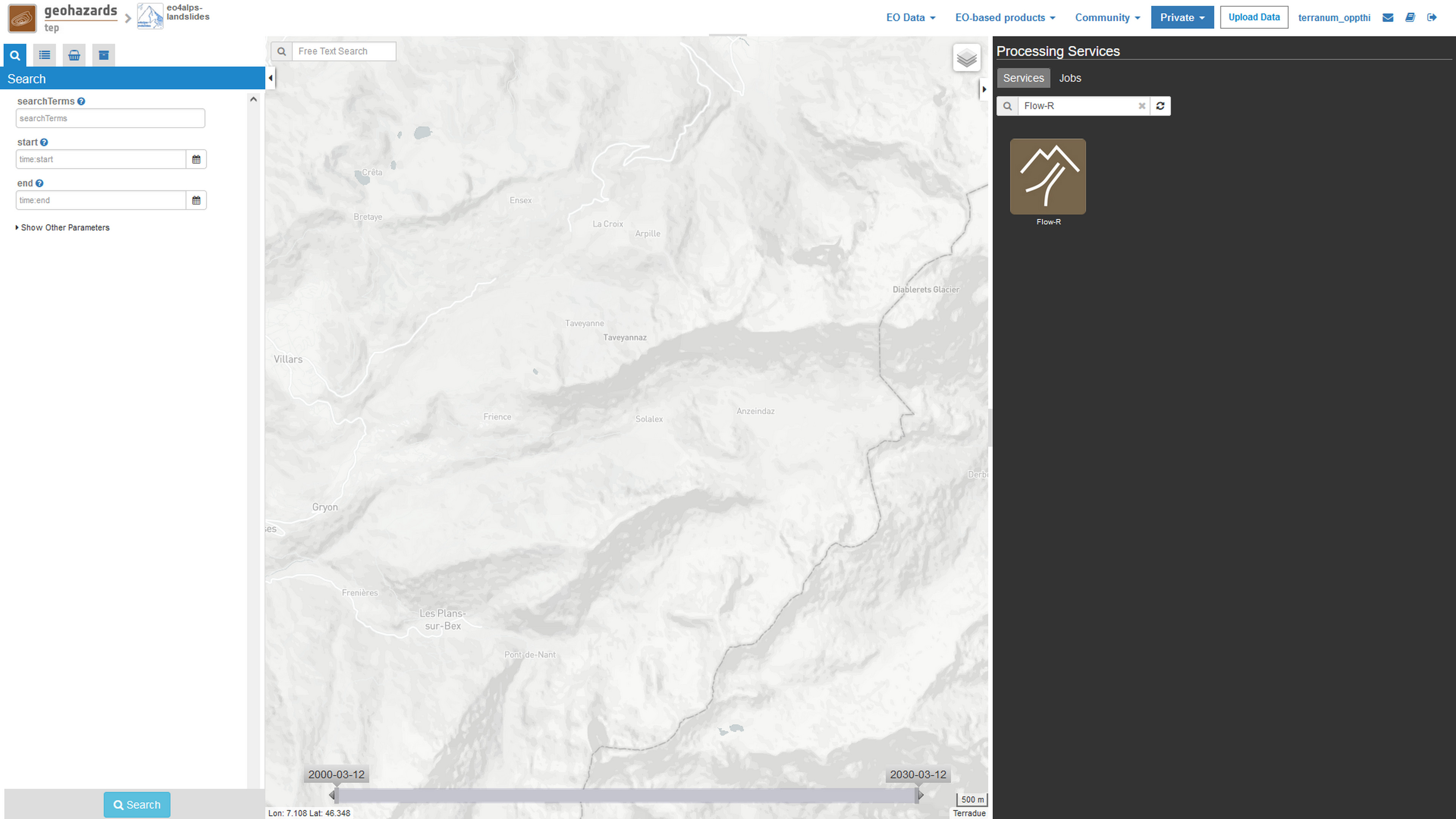
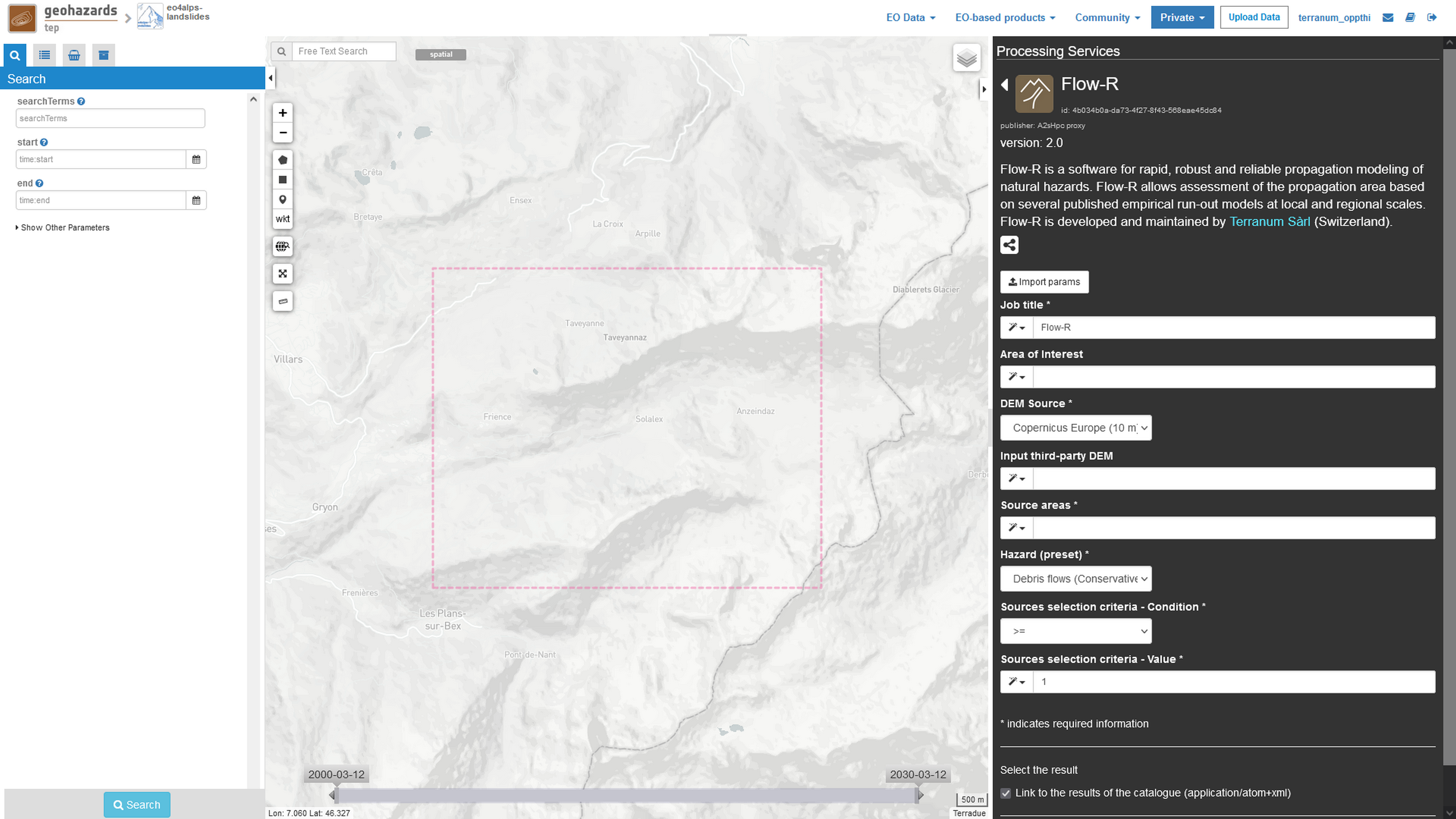
Flow-R stands for “Flow path assessment of gravitational hazards at a Regional scale” and is developed and maintained by Terranum Sàrl (Switzerland), a spin-off of the University of Lausanne. Flow-R is a software for rapid, robust, and reliable propagation modeling of natural hazards. It allows for the assessment of the propagation extent based on several published empirical run-out models at local and regional scales. Details on the Flow-R model can be found in Horton et al. (2013) [1]. Up to now, Flow-R has been adapted to runout computations of:
The Flow-R service on GEP (hereafter called Flow-R on GEP) contains parameter presets for these hazard types calibrated for extreme events in the Alps. Using these hazard presets therefore leads to conservative propagation extents appropriated for susceptibility or indicative hazard mapping at regional scale. Terranum Sàrl provides, on-demand, advanced processing including calibration of propagation parameters to local landslide inventories and the distinction between extreme, rare, and current landslide events using susceptibility levels (https://www.terranum.ch/en/consulting/natural-hazards/). Section 4. Flow-R advanced processing provides details on the advantages of the Flow-R advanced processing compared to the Flow-R on GEP propagation modelling.
Input specifications & supported EO data
Note
As best practice, these input files should have square cells, a metric coordinate system (e.g., UTM or national grid), metric elevation values and ideally 10 m cell size. Flow-R handles differences in cell size or extent between the DEM and source areas, but the required regridding may lead to errors. Possible differences in projection system are handled in the Flow-R service by reprojecting the DEM in the coordinate system of the source areas.
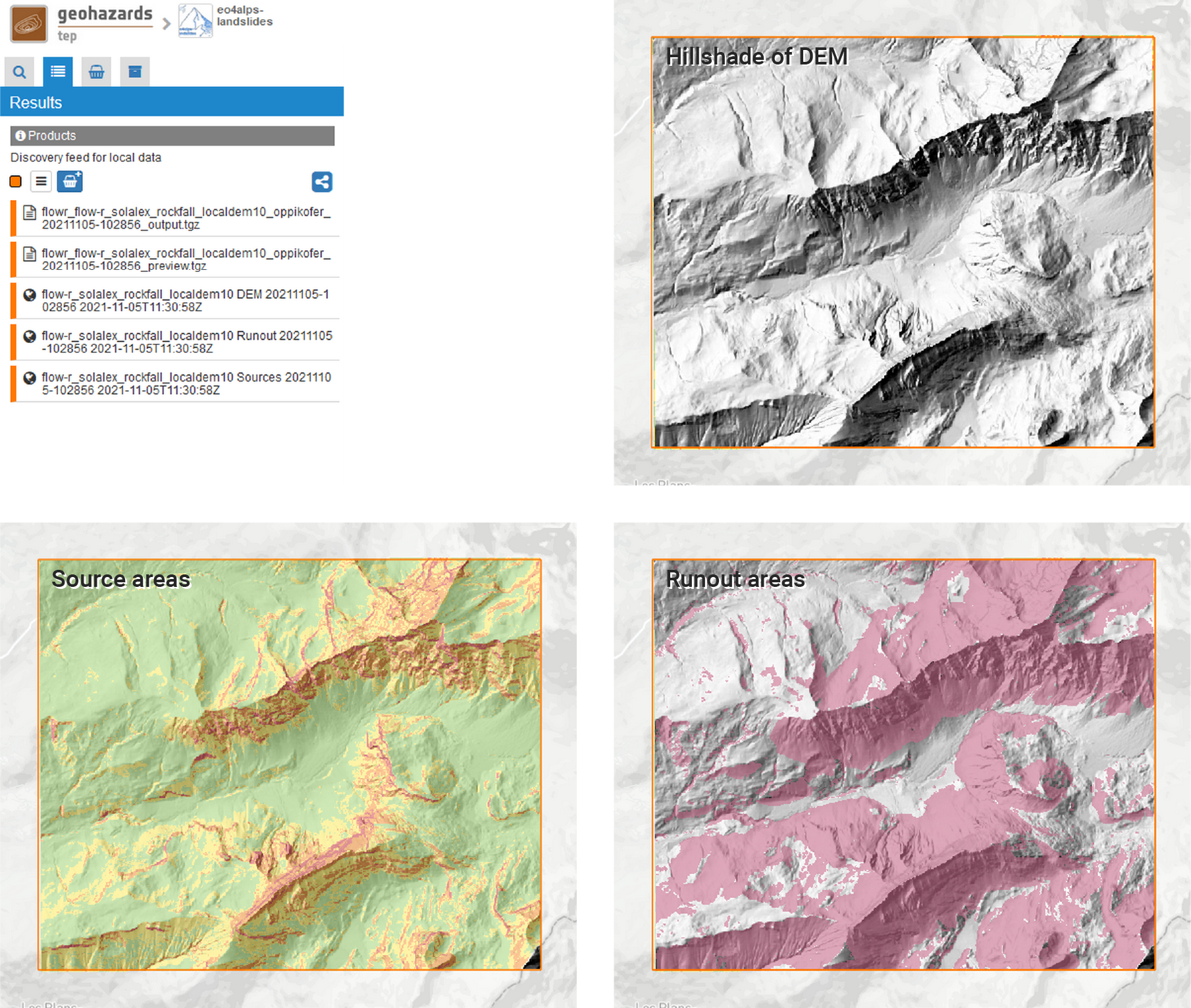
Output specifications
This section describes the preparation of input data required for the Flow-R service.
Note
This step is not mandatory but highly recommended, especially when a Copernicus DEM is used.
Note
This step is not required if the source areas are provided as outputs of other GEP services and if a provided DEM source is used (e.g., Copernicus Europe (10 m) or Copernicus World (30 m)).
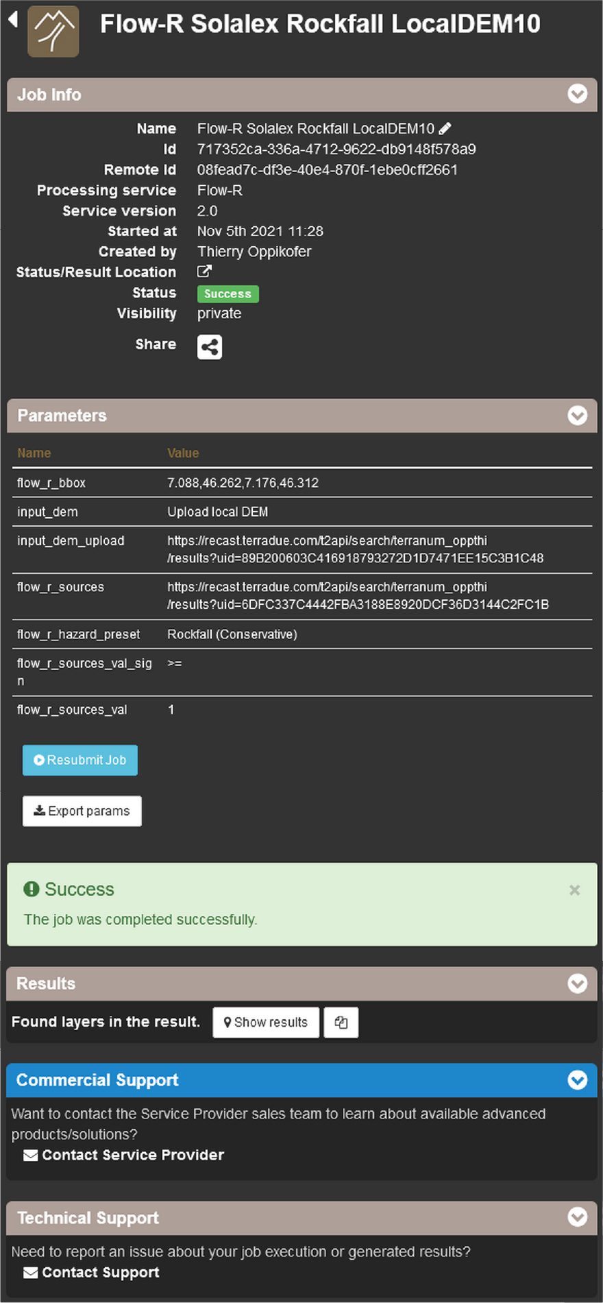
This section describes the different parameters of the Flow-R service on GEP.
Note
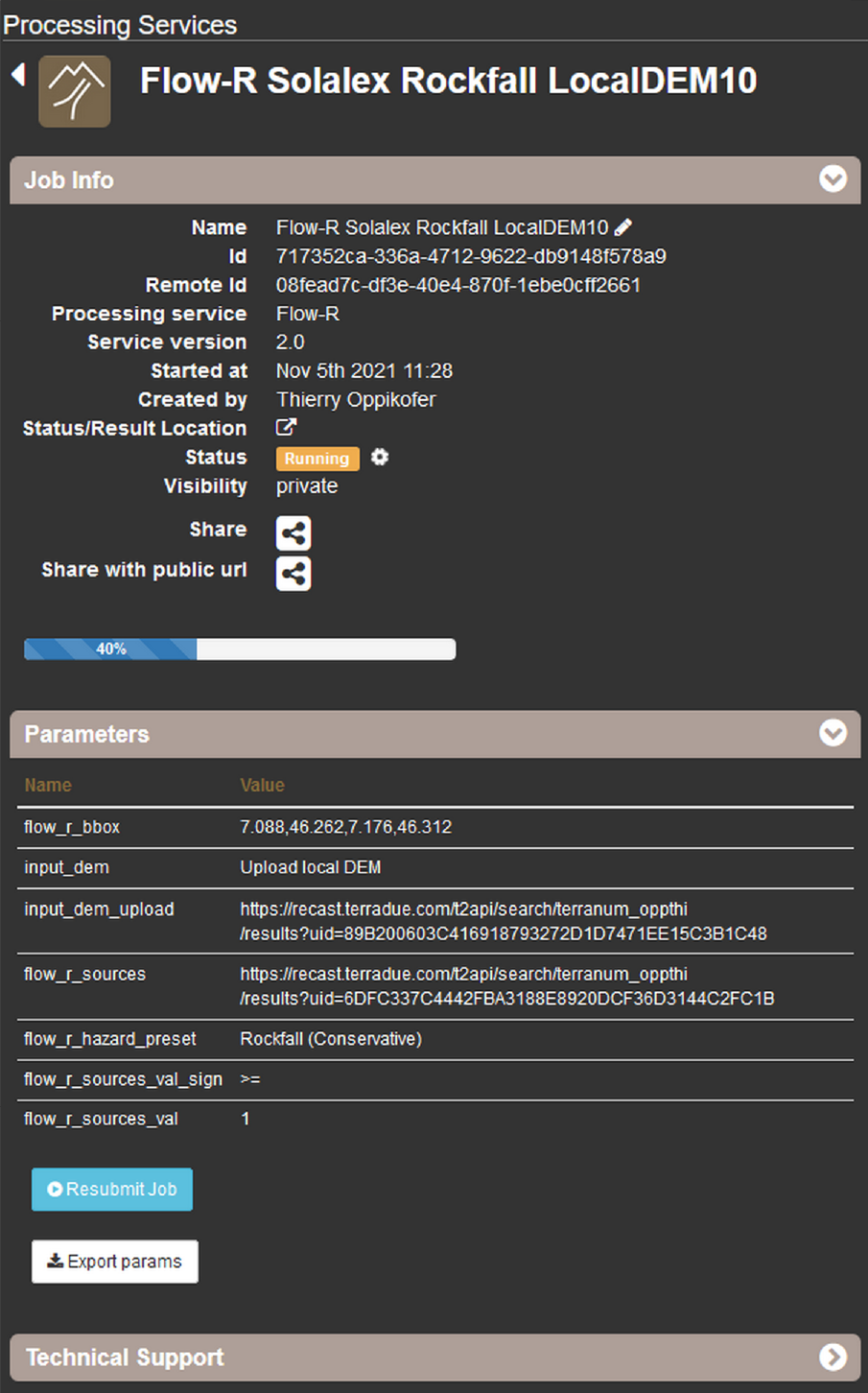
The date and time of the model run will be automatically added to the created output files (in UTC, Coordinated Universal Time).
Note
If not specified, the Area of Interest is cropped to the user-uploaded DEM (if Upload local DEM is chosen as DEM Source) or to the Source areas (if Copernicus Europe (10 m) or Copernicus World (30 m) are chosen as DEM Source).
Note
If Copernicus Europe (10 m) is selected as DEM Source but not available over the chosen AOI, the Flow-R service automatically switches to the Copernicus World (30 m) DEM.
Note
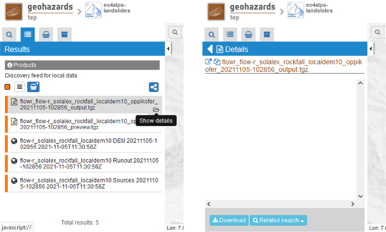
To access the uploaded files in your private storage click on Private –> My Store in the menu bar on the top. If an AOI is defined in the geobrowser (using the Draw polygon, Draw rectangle or wkt tools) only the user datasets that intersect the AOI are shown. Select the appropriate file and drag-and-drop it to the matching field in the Flow-R interface.
Note
The input source areas can contain different numerical values (integer only), representing for example different levels of susceptibility/hazard or different mass movement types. Using the Sources selection criteria parameters allows processing only specific sources. Usually, the source areas have a value of 1, while non-source pixels have a value of 0 or NoData. In that case, the default condition (>=) and value (1) will consider all source areas for the propagation.
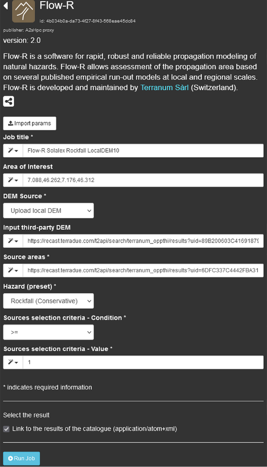
Flow-R on GEP contains parameter presets for these various hazard types calibrated for extreme events in the Alps. For the explanation of the various model parameters, the user is referred to the complete description of Flow-R in Horton et al. (2013) [1]. Following hazard presets are currently implemented:
Note
Additional information on the types of hazards (materials, failure mechanisms, and propagation behaviors implied) is detailed in Hungr et al. (2014) [6].
Note
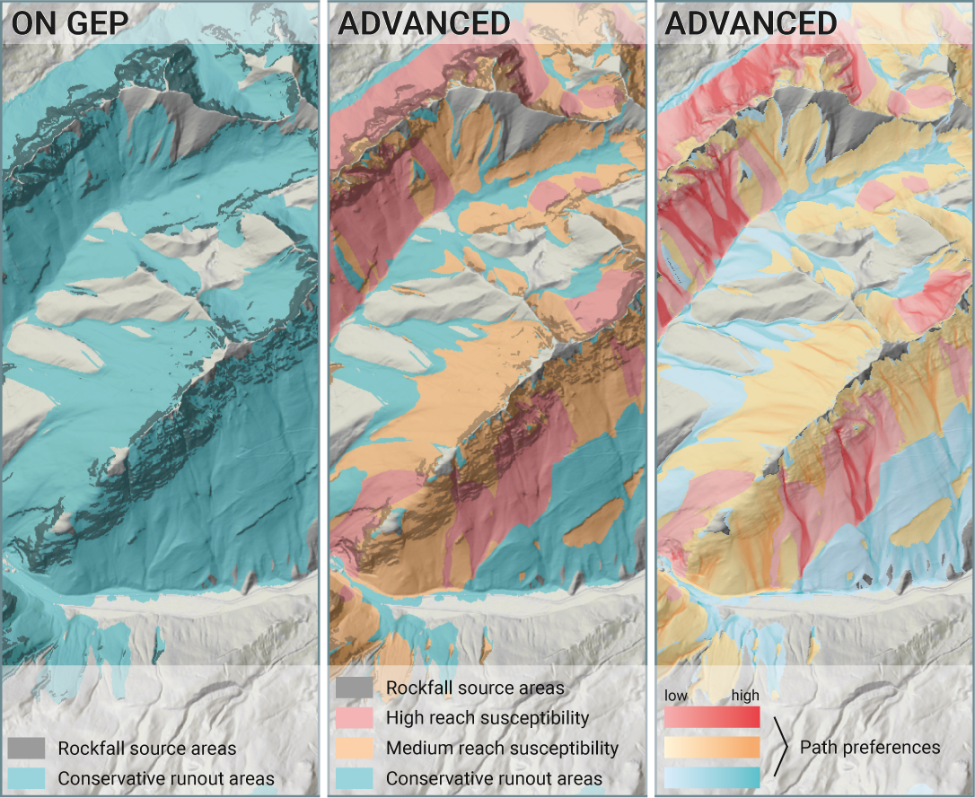
These hazard presents lead to conservative propagation extents appropriated for susceptibility or indicative hazard mapping at regional scale. Terranum Sàrl provides on-demand, advanced processing including calibration of propagation parameters to local landslide inventories and the distinction between extreme, rare, and current landslide events using susceptibility levels (https://www.terranum.ch/en/consulting/natural-hazards/). Section 4. Flow-R advanced processing provides details on the advantages of the Flow-R advanced processing compared to Flow-R on GEP propagation modelling.
Note
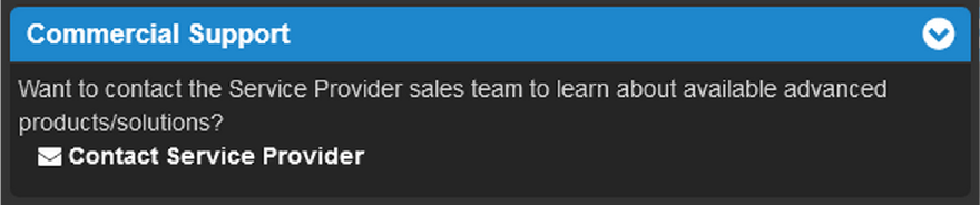
Clicking on the Contact Service Provider button under “Commercial Support” opens the contact form for Flow-R advanced modelling as detailed in section 4. Flow-R advanced processing.
Note
The runout areas are binary maps with the value of 1 for areas reached by the mass movement and the value of 0 for areas not reached. These runout areas discard pixels with a maximum reach susceptibility smaller than 0.005 (see Horton et al. (2013) [1] for details).
The Flow-R on GEP service uses predefined parameter sets for the different hazard types calibrated for extreme events in the Alps (see section 2.4 Flow-R hazard types), which lead to conservative propagation extents. Terranum, as service provider and developper of Flow-R, offers on-demand customized processing. This Flow-R advanced modelling is tailored to the user’s study area, requirements and available data. Flow-R advanced is based on extensive calibration and customization of model parameters, using for example databases and maps of past landslide events in the area of interest. Compared to the outputs of Flow-R on GEP, Flow-R advanced processing results include:
Moreover, Terranum has broad expertise in the assessment of source areas for all relevant landslide types.
If you want to complement results of a processed Flow-R on GEP job with Terranum’s advanced processing, send a request to Terranum by clicking on the Contact Service Provider button under “Commercial Support” in the detailed job information window.
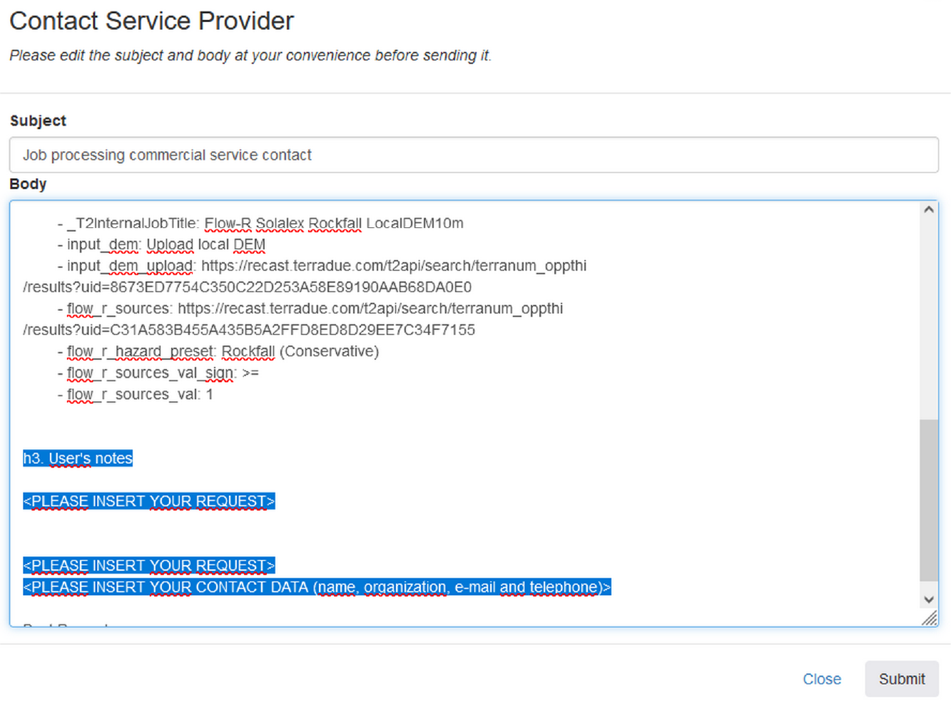
This opens the contact form for Flow-R advanced modelling, which automatically includes the parameterization of the selected Flow-R job. Please provide additional information about your request, particularly the study area, required scale/resolution, relevant hazard types and a brief description of available input data (DEM, source areas, datasets for calibration and validation etc.). Ideally, copy the text below and paste it into the User’s notes section of the contact form:
I am requesting a quote for Flow-R advanced processing based on this Flow-R job:
Note
For any questions about Flow-R advanced processing, you may contact Terranum via https://www.terranum.ch/en/about/
Users are kindly invited to report any issue and problem encountered during the use of the Flow-R service by issuing a ticket from their project support space on https://helpdesk.terradue.com/ or sending an email to support@terradue.com Suggestions and comments about the GEP service delivery are warmly welcomed on contact@geohazards-tep.eu to keep the service delivery on GEP as much as possible appealing, effective, and efficient.
Intellectual Property Right | The Intellectual Property Right of the Flow-R service (called “Service” hereafter) lies with Terranum Sàrl (Rue de l’Industrie 35b, CH-1030 Bussigny, Switzerland, called “Terranum”), if not differently specified. By using the Service, you agree to be bound by these Terms and Conditions and that they are enforceable like any written negotiated agreement signed by you. In case of any concern with these Terms and Conditions, please contact Terranum via https://www.terranum.ch/en/about/ for additional information before using the Service.
Use | The Service is available to all GEP users according to a CC-BY license [7]. There is the possibility that users participate in the cost of service maintenance and operation: these costs are defined case-by-case among the Service provider, Terranum, the Ressource provider, Conectus/EOST, and the Platform operator, Terradue Srl.
Results | The results of the Service are freely shareable and adaptable with appropriate credits under the CC-BY license [7].
Warranty and limitation of liability | Terranum accepts no responsibility for the operation or performance of the Service. The entire risk of use and consequences of use of the Service falls completely on you and Terranum shall not be liable in any respect for any loss claims or injury alleged to have resulted from use of or in reliance on software product. In this respect, you shall indemnify and defend against any and all claims, including claims by third parties or by your employees, which arise directly or indirectly out of your use or operation of the Service. Terranum’s sole obligation under this warranty is to use reasonable efforts to correct any non-conforming software. You acknowledge that you have read the foregoing disclaimers of warranty and limitation of liability and understand that you assume the entire risk of use of the Service. In no event will Terranum be liable to you for any damages, claims or costs whatsoever or any consequential, indirect, incidental damages, or any lost profits or lost savings, even if a Terranum representative has been advised of the possibility of such losses, damages, claims or costs or for any claim by any third party. Terranum will not be liable for any damages whatsoever (including, without limitation, damages for loss of business profits, business interruption, loss of business information, or other pecuniary loss) arising out of the use of or inability to use the Service, even if Terranum has been advised of the possibility of such damages. In any case, Terranum’s entire liability under any provision of this agreement shall be limited to the amount actually paid by you for the Service. The foregoing limitations and exclusions apply to the extent permitted by applicable law in your jurisdiction. Terranum’s aggregate liability and that of its suppliers under or in connection with this agreement shall be limited to the amount paid for the software, if any.
| [1] | (1, 2, 3, 4) Horton, P., Jaboyedoff, M., Rudaz, B., and Zimmermann, M. (2013): Flow-R, a model for susceptibility mapping of debris flows and other gravitational hazards at a regional scale. Natural Hazards Earth System Sciences 13, 869-885, doi:10.5194/nhess-13-869-2013. |
| [2] | (1, 2, 3, 4) ESA (2021): Copernicus DEM - Global and European Digital Elevation Model (COP-DEM). Website of the European Space Agency, https://spacedata.copernicus.eu/web/cscda/dataset-details?articleId=394198 |
| [3] | Holmgren, P. (1994): Multiple flow direction algorithms for runoff modelling in grid based elevation models: An empirical evaluation. Hydrol. Process. 8, 327–334, doi:10.1002/hyp.3360080405. |
| [4] | Gamma, P. (200): dfwalk – Ein Murgang-Simulationsprogramm zur Gefahrenzonierung. PhD thesis, Geographisches Institut der Universität Bern (in German). |
| [5] | Perla, R., Cheng, T.T., and McClung, D.M. (1980): A two-parameter model of snow-avalanche motion. J. Glaciol. 26, 197–207. |
| [6] | Hungr, O., Leroueil, S., and Picarelli, L. (2014): The Varnes classification of landslide types, an update. Landslides. 11, 167-194. |
| [7] | (1, 2) Creative Commons Attribution 4.0 International (CC BY) licence: https://creativecommons.org/licenses/by/4.0/ |
