S-1 SAR PIPE - Sentinel-1 Interferometric Processing Engine
S-1 SAR PIPE is a Sentinel-1 SAR data processing chain developed by ARESYS.
This service allows to produce interferograms and coherence maps starting from Sentinel-1 RAW data, supporting both STRIPMAP and TOPSAR (IW and EW) acquisition modes.
Its main advantages are:
EO sources supported:
Output specifications
The service provides 2 output products:
| Interferogram | |
|---|---|
| Correspondent file | Interferogram |
| Information types | Interferogram (abs and phase) computed from input RAW couple, focused and coregistered |
| Raster format | GeoTIFF |
| Resolution | Native (same as Level-1 SLC products) |
| Projection types | SAR coordinates (slant range vs azimuth) |
| Bit depth | Float 32 complex |
| Processing Level | L2 |
| Physical product available | YES |
| Browse product available | YES (both GeoTIFF and PNG) |
| Output Filename example | <product name>_interferogram.tif |
| Coherence map | |
|---|---|
| Correspondent file | Coherence map |
| Information types | Coherence map computed from input RAW couple, focused and coregistered |
| Raster format | GeoTIFF |
| Resolution | Native (same as Level-1 SLC products) |
| Projection types | SAR coordinates (slant range vs azimuth) |
| Bit depth | Float 32 |
| Processing Level | L2 |
| Physical product available | YES |
| Browse product available | YES (both GeoTIFF and PNG) |
| Output Filename example | <product name>_coherence.tif |
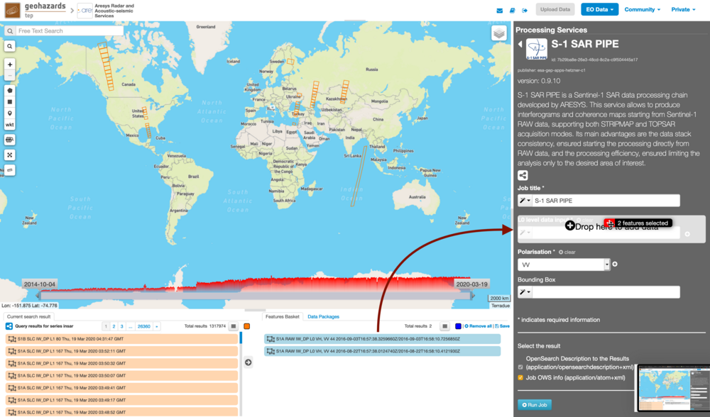
This service takes as input a list of Sentinel-1 RAW products.
The oldest image is selected to be the Master one, i.e. the reference product on which the others (the Slaves) are re-projected and resampled to compute the interferometric phase and interferometric coherence.
Input SAR data selection must be carried out with particular care, since a wrong data selection can result to an unfeasible processing:
- The processing service accepts as inputs only Sentinel-1 RAW (i.e. Level-0) data.
- The Sentinel-1 RAW data must pertain to the same acquisition mode.
- The user must select images related to the same track only.
- The user must select images related to the same polarization only.
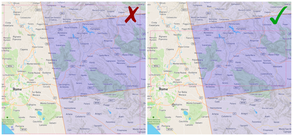
- Spatial overlap is strictly needed between the images pair.
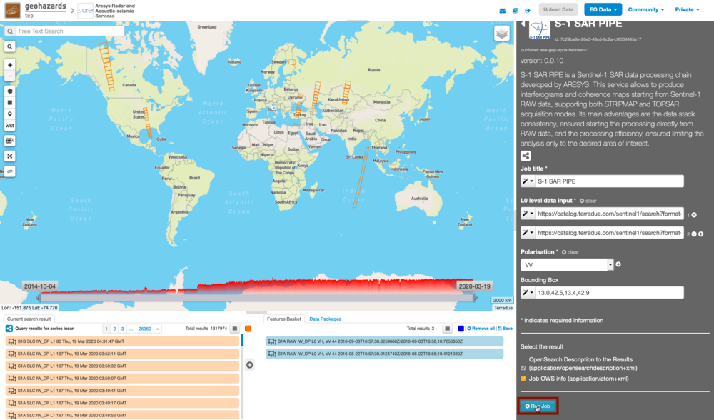
For this tutorial, a pre-defined data set has been prepared to speed up data selection step:
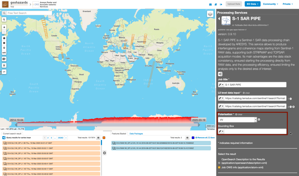
S-1 SAR PIPE processes only one polarisation channel that can be selected between:
- VV: Vertical in both transmission and receiving phases, contained in DV and SV products (default value).
- VH: Vertical in transmission phase and Horizontal in receiving phase, contained only in DV products.
- HH: Horizontal in both transmission and receiving phases, contained in DH and SH products.
- HV: Horizontal in transmission phase and Vertical in receiving phase, contained only in DH products.
For this run leave the VV default value.
With this parameter is possible to set the AOI (Area Of Interest) where the interferometric processing is performed. The AOI format is:
lon_min,lat_min,lon_max,lat_max
For this run set this AOI: 13.0,42.5,13.4,42.9
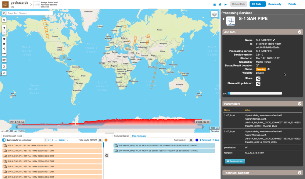
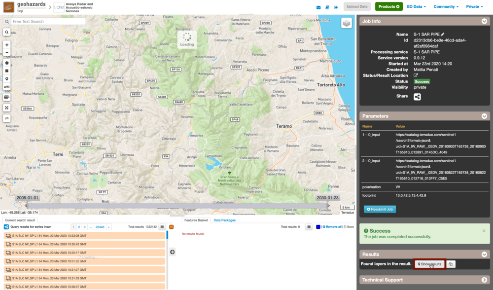
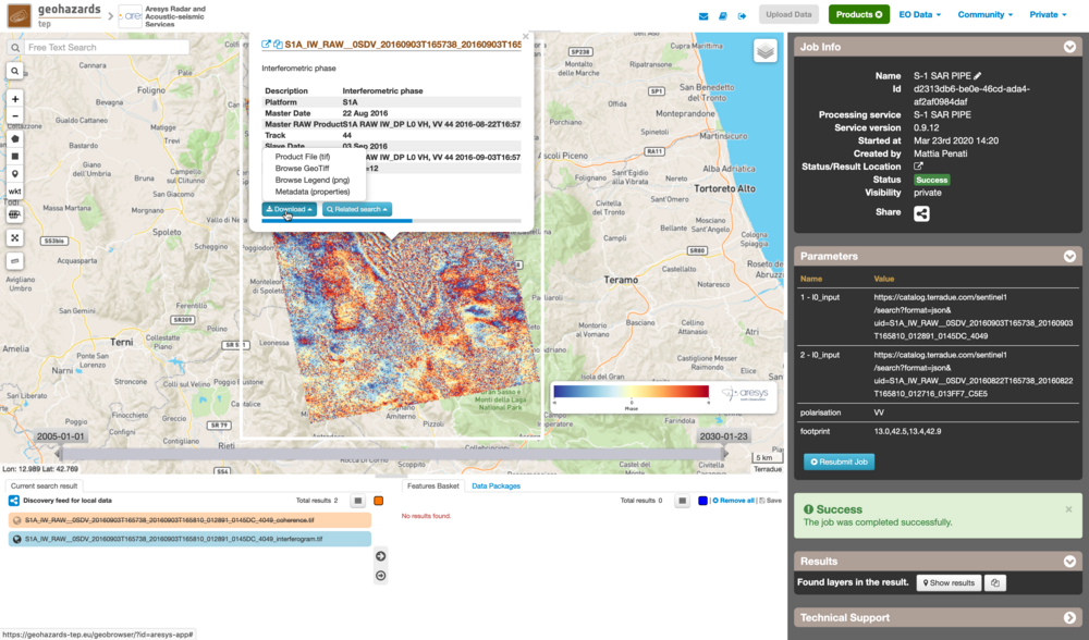
The following outputs are listed:
- <product name>_interferogram.tif: this is the product that contains the interferogram computed between Master and Slave images. The Browse product is shown on the map and both Physical and Browse products are available for download.
- <product name>_coherence.tif: this is the product that contains the coherence map computed between Master and Slave images. The Browse product is shown on the map and both Physical and Browse products are available for download.
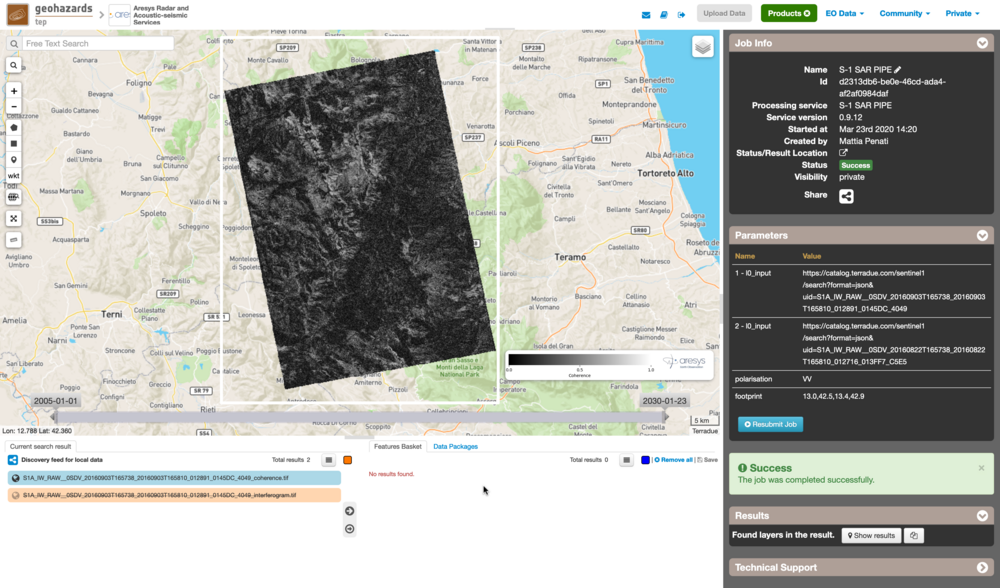
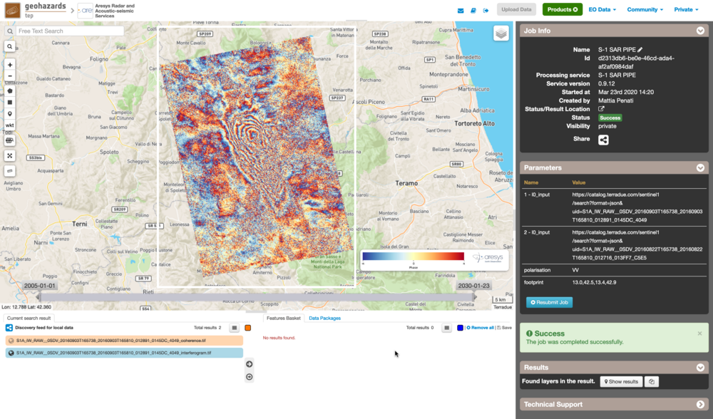
Click on the product name and then on the Download button that appears in the info tab. Depending on the output the following products can be downloaded:
- Product File (tif): this is the physical quantity.
- Browse GeoTiff: this is the GeoTiff browse product as shown on the map.
- Browse Legend (png): this is the PNG browse product.
- Metadata (properties): a txt file containing all the metadata info displayed in the info tab.
