by Terranum Sàrl (Switzerland)
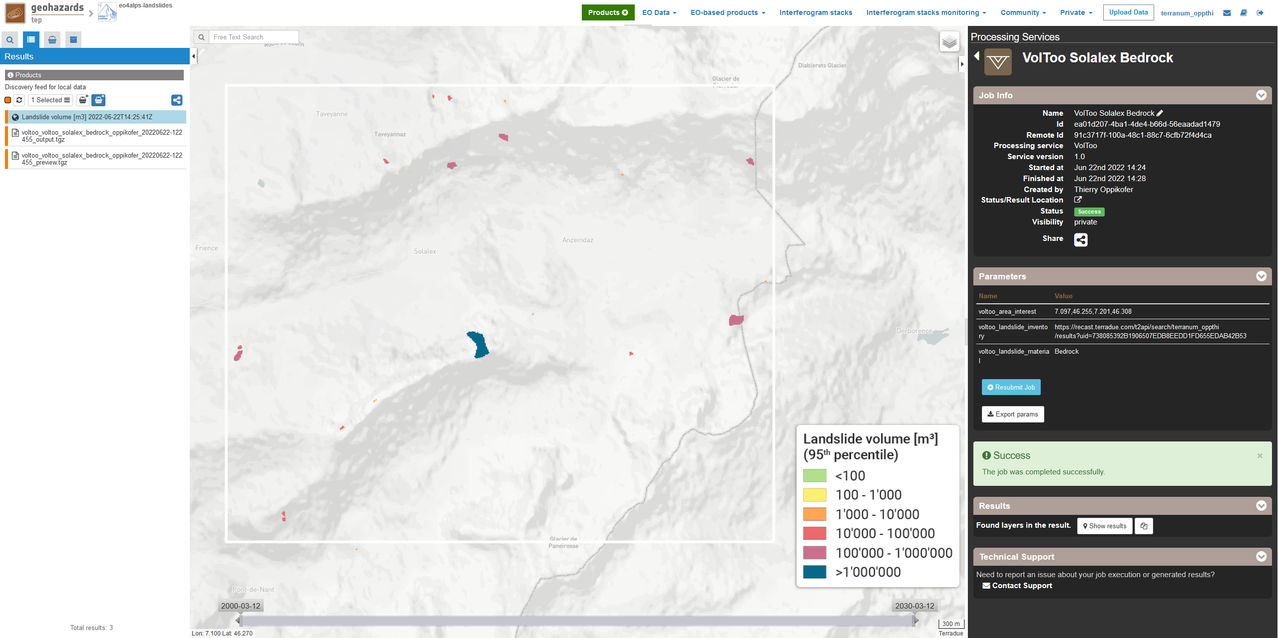
VolToo is a tool for assessment of landslide source volumes taking into account their material types (soil, bedrock or undifferentiated). It uses empirical relationships linking landslide area to landslide volume, based on a global compilation of landslide inventories [1]. The VolToo service is mainly intended as pre-processing step in landslide hazard assessment, for example prior to landslide runout modelling using the Flow-R service [2]. VolToo is developed and maintained by Terranum Sàrl (Switzerland).
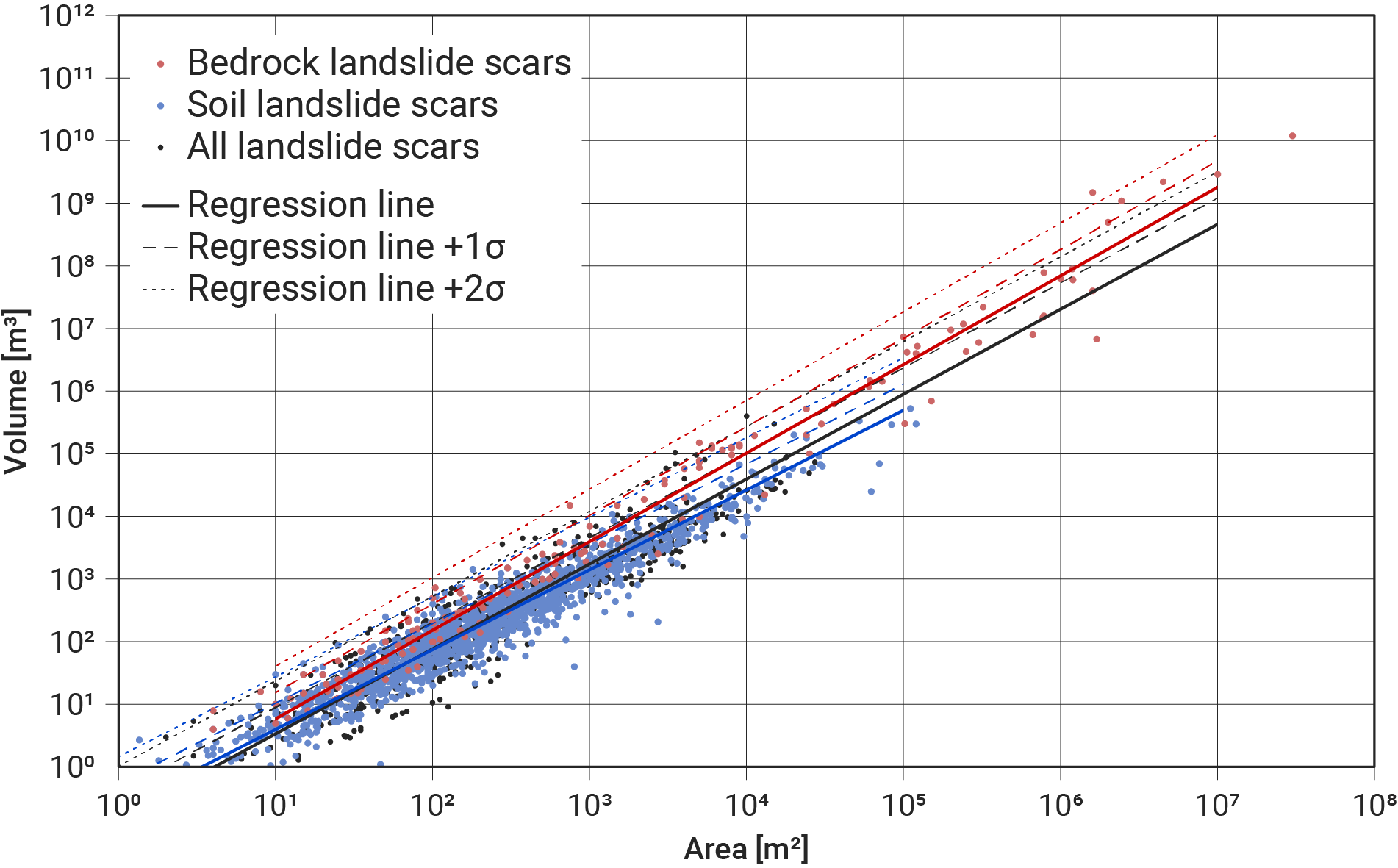
VolToo uses the global landslide dataset by Larsen et al. (2010) [1] for different landslide materials (soil, bedrock or undifferentiated) to assess the landslide volume for each landslide source area. Because of the huge spread in the empirical dataset (landslide volumes can span over two orders of magnitude for a given landslide area), VolToo assesses also the uncertainties on the volume assessment by computing the 50th, 75th and 95th percentile of the possible volume range.
Input specifications
Note
Make sure that the input file has a defined coordinate system (e.g., UTM, national grid or other any system with an EPSG code). The input file can be either as polygons (ideally single part polygons; multipart polygons will be automatically split into single polygons), or Geotiff raster files (ideally with a unique identifier as raster value).
Output specifications
This section describes the preparation of input data required for the VolToo service.
Note
This step is not required if the landslide source areas are provided as outputs of other GEP services.
Note
This step is not mandatory if you want to compute the volume of all landslide source areas in the provided inventory.
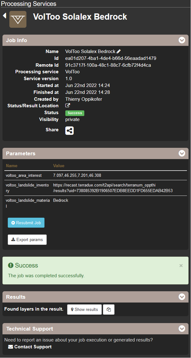
This section describes the different parameters of the VolToo service on GEP.
Note
The date and time of the model run will be automatically added to the created output files (in UTC, Coordinated Universal Time).
Note
If not specified, the entire landslide inventory will be processed.
Note
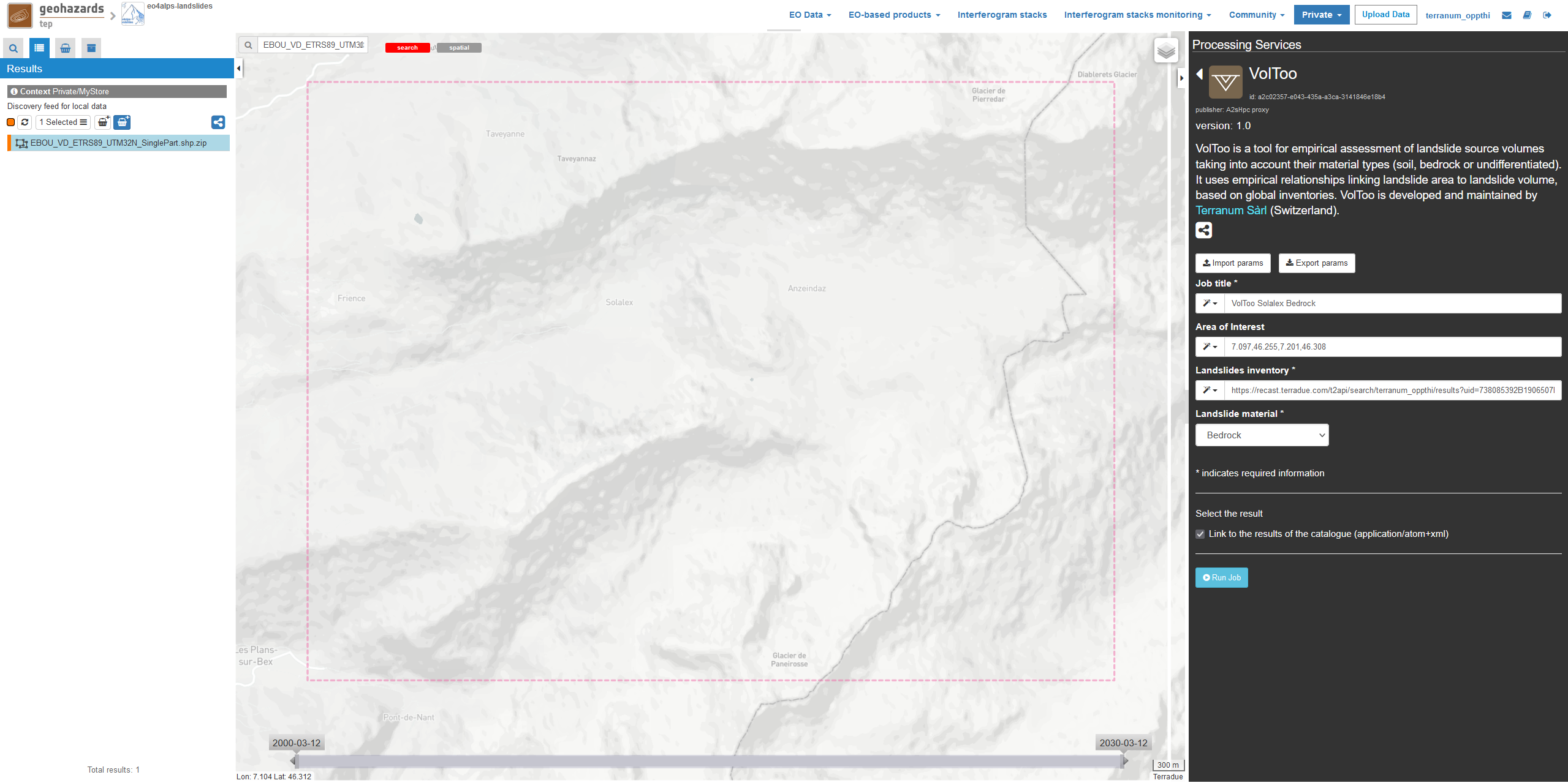
To access the uploaded files in your private storage click on Private –> My Store in the menu bar on the top. If an AOI is defined in the geobrowser (using the Draw polygon, Draw rectangle or wkt tools) only the user datasets that intersect the AOI are shown. Select the appropriate file and drag-and-drop it to the matching field in the VolToo interface.
Users are kindly invited to report any issue and problem encountered during the use of the VolToo service by issuing a ticket from their project support space on https://helpdesk.terradue.com/ or sending an email to support@terradue.com Suggestions and comments about the GEP service delivery are warmly welcomed on contact@geohazards-tep.eu to keep the service delivery on GEP as much as possible appealing, effective, and efficient.
Intellectual Property Right | The Intellectual Property Right of the VolToo service (called “Service” hereafter) lies with Terranum Sàrl (Rue de l’Industrie 35b, CH-1030 Bussigny, Switzerland, called “Terranum”), if not differently specified. By using the Service, you agree to be bound by these Terms and Conditions and that they are enforceable like any written negotiated agreement signed by you. In case of any concern with these Terms and Conditions, please contact Terranum via https://www.terranum.ch/en/about/ for additional information before using the Service.
Use | The Service is available to all GEP users according to a CC-BY license [5]. There is the possibility that users participate in the cost of service maintenance and operation: these costs are defined case-by-case among the Service provider, Terranum, the Ressource provider, Conectus/EOST, and the Platform operator, Terradue Srl.
Results | The results of the Service are freely shareable and adaptable with appropriate credits under the CC-BY license [5].
Warranty and limitation of liability | Terranum accepts no responsibility for the operation or performance of the Service. The entire risk of use and consequences of use of the Service falls completely on you and Terranum shall not be liable in any respect for any loss claims or injury alleged to have resulted from use of or in reliance on software product. In this respect, you shall indemnify and defend against any and all claims, including claims by third parties or by your employees, which arise directly or indirectly out of your use or operation of the Service. Terranum’s sole obligation under this warranty is to use reasonable efforts to correct any non-conforming software. You acknowledge that you have read the foregoing disclaimers of warranty and limitation of liability and understand that you assume the entire risk of use of the Service. In no event will Terranum be liable to you for any damages, claims or costs whatsoever or any consequential, indirect, incidental damages, or any lost profits or lost savings, even if a Terranum representative has been advised of the possibility of such losses, damages, claims or costs or for any claim by any third party. Terranum will not be liable for any damages whatsoever (including, without limitation, damages for loss of business profits, business interruption, loss of business information, or other pecuniary loss) arising out of the use of or inability to use the Service, even if Terranum has been advised of the possibility of such damages. In any case, Terranum’s entire liability under any provision of this agreement shall be limited to the amount actually paid by you for the Service. The foregoing limitations and exclusions apply to the extent permitted by applicable law in your jurisdiction. Terranum’s aggregate liability and that of its suppliers under or in connection with this agreement shall be limited to the amount paid for the software, if any.
| [1] | (1, 2) Larsen, I.J., Montgomery, D.R., Korup, O. (2010): Landslide erosion controlled by hillslope material. Nature Geoscience, 3, 247-251. |
| [2] | Flow-R: Flow Path Assessment of Gravitational Hazards at a Regional Scale. On-demand processing service on GEP: https://docs.terradue.com/geohazards-tep/tutorials/Flow-R.html |
| [3] | ALADIM-HR: Automatic LAndslide Detection and Inventory Mapping from multispectral S2 & L8 data. On-demand processing service on GEP: https://docs.terradue.com/geohazards-tep/tutorials/aladim-hr.html |
| [4] | ALADIM-VHR: Automatic LAndslide Detection and Inventory Mapping from multispectral Very-High Resolution data. On-demand processing service on GEP: https://docs.terradue.com/geohazards-tep/tutorials/aladim_vhr.html |
| [5] | (1, 2) Creative Commons Attribution 4.0 International (CC BY) licence: https://creativecommons.org/licenses/by/4.0/ |
