by NORCE AS
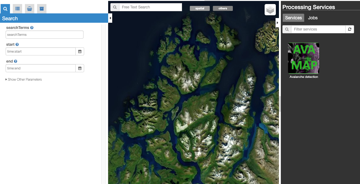
AVAMAP is a tool for mapping snow avalanches from Sentinel-1 data. The tool has been developed by the Norwegian Research Center - NORCE AS. It is based on change detection between pairs of repeat-pass SAR aquisitions [1].
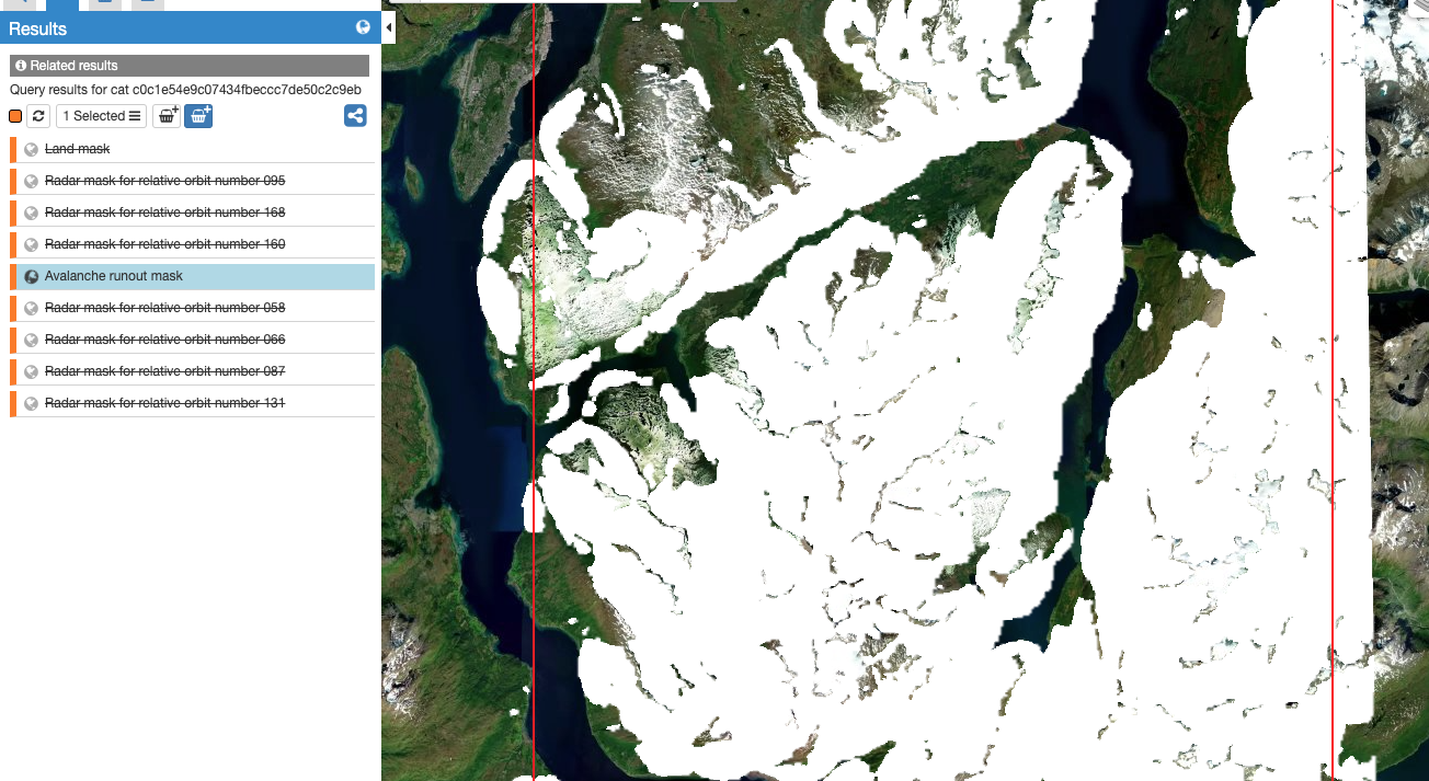
The detection algorithm is restricted by a set of masks, including: * Radar mask: indicating lack of data due to radar shadow and layover (one mask for each relative orbit of Sentinel-1) * Runout mask: indicating avalanche runout zones based on the local topography * Land mask: Indicate land (vs ocean)
The detection algorithm will only detect snow avalanches where these three masks are non-zero. The masks has been prepared on the GEP plarform, and can be visualized by selecting Masks on the top pane:
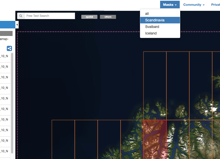
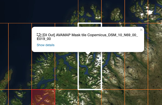
The masks are prepared in terms of tiles, which appear as bounding boxes on the map: Select a tile and click Show details, followed by Show results at the bottom left to visualize the masks:
Here, for instance, is the avalanche runout mask highlighted. White areas indicate where avalanches can potentially be found given the local topography:
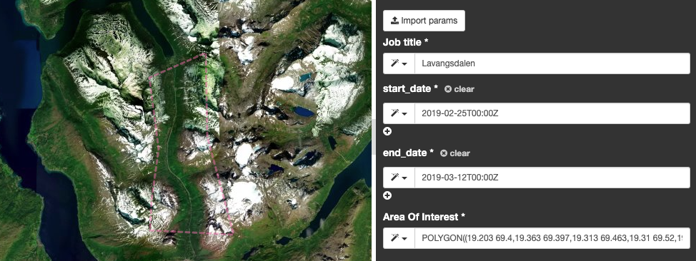
Apart from a Job title, the tool only requires three inputs from the user: * Start date: ISO8601-formatted time (UTC) * End date: ISO8601-formatted time (UTC) * Area of interest: Polygon as WKT-string

The Area of interest must be a polygon, and inputted either as a WKT, or can be imported from a polygon drawn on the map:
To run the job, simply click Run Job.
Note
Since the revisit time of the Sentinel-1 satellites is typically 6-12 days, the time separation between Start date and End date should be at least this long in order include pairs of repeat-pass aquisitions.
Note
Depending on the size of your area of interst, the time separation between start and end date, and processing capability of the GEP platform, the processing can take several hours.
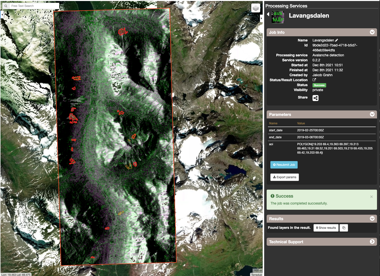
Open the finished job, and click Show results on the Results pane to show the results. The results consists:
Here, results are shown for Lavangsdalen in Northern Norway
Note
Lavangsdalen is particlulary sensitive to snow avalanches since the main road to the city of Tromsø goes through the valley.
Note
The file naming convention for detections is: avaldet_[GRID_ID]_[RELATIVE_ORBIT_NUMBER]_[DATE_FIRST_PASS]_[DATE_SECOND_PASS]_[IMAGE_COUNT]_[TOTAL_COUNT].geojson
Note
The file naming convention for detections is: rgb_[GRID_ID]_[RELATIVE_ORBIT_NUMBER]_[DATE_FIRST_PASS]_[DATE_SECOND_PASS].geojson
| [1] | Eckerstorfer M, Vickers H, Malnes E, Grahn J. Near-Real Time Automatic Snow Avalanche Activity Monitoring System Using Sentinel-1 SAR Data in Norway. Remote Sensing. 2019; 11(23):2863. https://doi.org/10.3390/rs11232863 |
