Sentinel-2 Burned Area Analysis
This service takes as input a pair (pre-event and post-event) of Sentinel-2 MSI L2A products and generates a Burned Area Analysis map and NIR/SVWI RGB composites for the two input Sentinel-2 acquisitions.
This service gives the best results when the post fire image is very close to the fire date.
The masks for the water masks are applied by the service.
EO sources supported
- Sentinel-2 MSI L2A
Output specifications
The service provides the following output product.
| Output – Burned Area Analysis map | |
|---|---|
| Correspondent file | Burned Area Analysis map |
| Raster format | GeoTIFF |
| resolution | Native |
| Projection types | EPSG:3857 - WGS84 – Pseudo Mercator |
| Output Filename example | Burned area analysis (2020-10-05T07:37:49.0240000Z/2020-10-15T07:39:09.0240000Z) |
| Output – NIR/SVWI RGB composite of the pre-event input | |
|---|---|
| Correspondent file | NIR/SVWI RGB composite of the pre-event input |
| Raster format | GeoTIFF |
| resolution | Native |
| Projection types | EPSG:3857 - WGS84 – Pseudo Mercator |
| Output Filename example | NIR/SVWI RGB composite (2019-08-15T14:01:01.0240000Z/2019-08-15T14:01:01.0240000Z) |
| Output – NIR/SVWI RGB composite of the post-event input | |
|---|---|
| Correspondent file | NIR/SVWI RGB composite of the post-event input |
| Raster format | GeoTIFF |
| resolution | Native |
| Projection types | EPSG:3857 - WGS84 – Pseudo Mercator |
| Output Filename example | NIR/SVWI RGB composite (2019-08-30T14:00:59.0240000Z/2019-08-30T14:00:59.0240000Z) |
| Output – notebook used for generating dNBR and RBR | |
|---|---|
| Correspondent file | notebook used for generating dNBR and RBR |
| File format | python file (ipynb) |
| Output Filename example | Reproducibility notebook used for generating dNBR and RBR |
| Output – stage-in notebook for Sentinel-2 data for generating dNBR and RBR | |
|---|---|
| Correspondent file | notebook for Sentinel-2 data for generating dNBR and RBR |
| File format | python file (ipynb) |
| Output Filename example | Reproducibility stage-in notebook for Sentinel-2 data for generating dNBR and RBR |
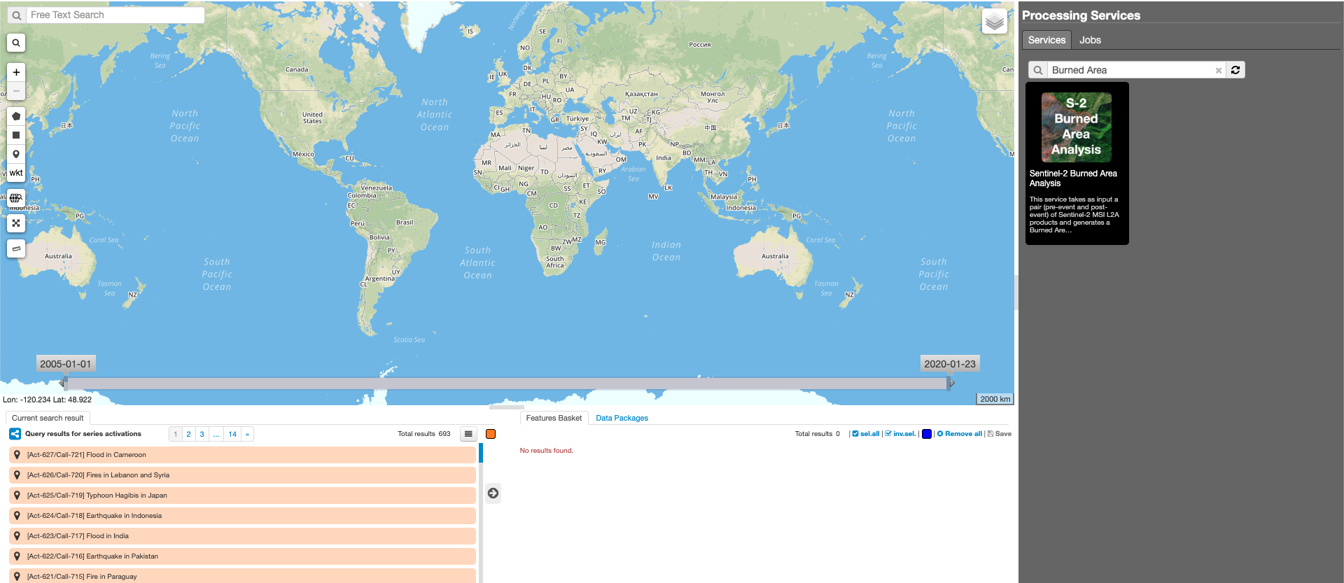
This tutorial will describe the processing of a pair of Sentinel-2 MSI images to generate a Burned Area Analysis map and NIR/SVWI RGB composites for the two input Sentinel-2 acquisitions on the GEP.
The Burned Area map is obtained through the interesection between AOI and the pre-fire, post-fire Sentinel-2 choosen as input products.
The formula used to estimate burn severity is the Normalized Band Ratio (NBR):
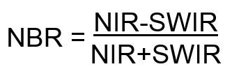
A high NBR value indicates healthy vegetation while a low value indicates bare ground and recently burnt areas. Non-burnt areas are normally attributed to values close to zero. The Burned Area Analysis product output of the service provides the delta Normalized Burn Ratio (dNBR) and the Relativized Burn Ratio (RBR). The dNBR (the difference between pre-fire and post-fire) is useful to identify recently burned areas and differentiate them from bare soil and other non-vegetated areas. The RBR is advantageous when the absolute change between pre-fire and post-fire NBR is small.
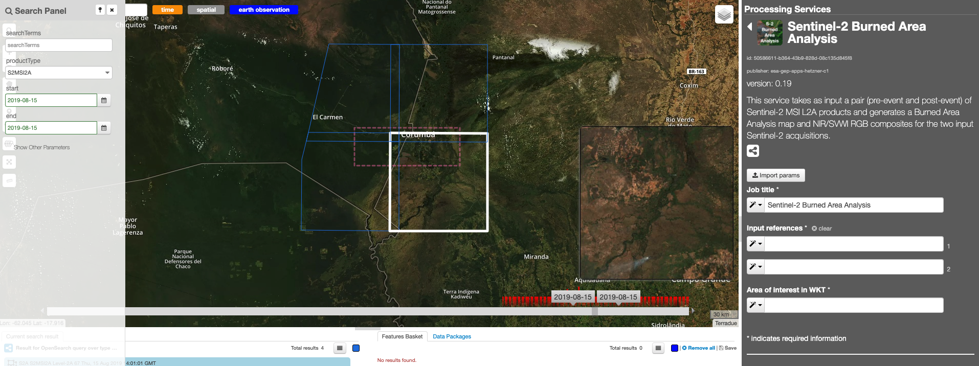
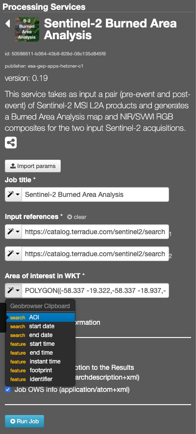
The “Sentinel-2 Burned Area Analysis” panel is displayed with parameters values to be filled-in.
Note
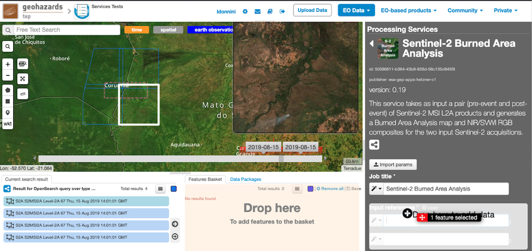
pre-event input can be picked up directly by using the following text filter: S2A_MSIL2A_20190815T140101_N0213_R067_T21KUU_20190815T214633
Pick one of the results having the same track, then drag and drop one of the results in the Input reference field:
Note
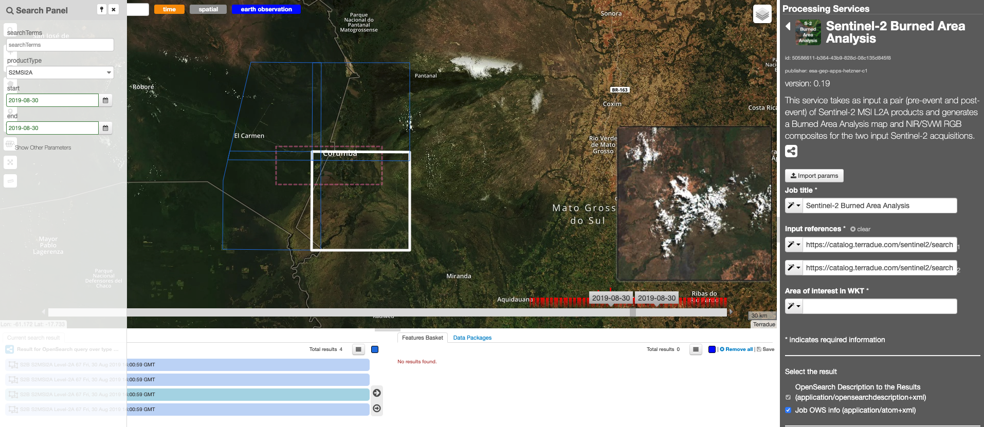
post-event input can be picked up directly by using the following text filter: S2B_MSIL2A_20190830T140059_N0213_R067_T21KUU_20190830T180923
Note
you can also specify manually a different AOI in WKT format, or draw a new area on the map using the search tool and get its value from the Magic tool wizard.
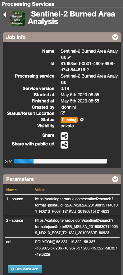
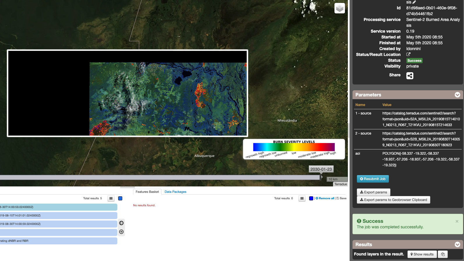
The following files are produced:
- Burned area analysis (2019-08-15T14:01:01.0240000Z/2019-08-30T14:00:59.0240000Z): Burned area analysis map
- NIR/SVWI RGB composite (2019-08-15T14:01:01.0240000Z/2019-08-15T14:01:01.0240000Z): NIR/SVWI RGB composite of the pre-event input
- NIR/SVWI RGB composite (2019-08-30T14:00:59.0240000Z/2019-08-30T14:00:59.0240000Z): NIR/SVWI RGB composite of the post-event input
- Reproducibility notebook used for generating dNBR and RBR: notebook used for generating dNBR and RBR
- Reproducibility stage-in notebook for Sentinel-2 data for generating dNBR and RBR: notebook for Sentinel-2 data for generating dNBR and RBR
