DLR Sentinel-1 InSAR Browse [VAL]

DLR Sentinel-1 InSAR Browse
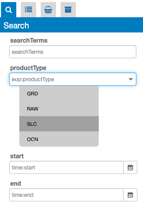
This service generates 10 InSAR browse products from a pair of Sentinel-1 SLC images over seismically active areas and active volcanoes using DLR’s Integrated Wide Area Processor (IWAP). It has a max resolution of 50 and a spacing of 25 metres.
EO sources supported
Output specifications
| Output – Amplitude Change Composite |
|---|
| Correspondent file |
S-1 High-Resolution InSAR Browse Service - Amplitude Change Composite |
| Raster format |
GeoTIFF |
| resolution |
Native |
| Projection types |
EPSG:3857 - WGS84 – Pseudo Mercator |
| Output Filename example |
S-1 High-Resolution InSAR Browse Service - Amplitude Change Composite - 2019-07-04T08:21:14 2019-07-16T08:21:40 |
| Output – Coherence Amplitude Composite |
|---|
| Correspondent file |
S-1 High-Resolution InSAR Browse Service - Coherence Amplitude Composite |
| Raster format |
GeoTIFF |
| resolution |
Native |
| Projection types |
EPSG:3857 - WGS84 – Pseudo Mercator |
| Output Filename example |
S-1 High-Resolution InSAR Browse Service - Coherence Amplitude Composite - 2019-07-04T08:21:14 2019-07-16T08:21:40 |
| Output – Coherence Terrain Corrected |
|---|
| Correspondent file |
S-1 High-Resolution InSAR Browse Service - Coherence Terrain Corrected |
| Raster format |
GeoTIFF |
| resolution |
Native |
| Projection types |
EPSG:3857 - WGS84 – Pseudo Mercator |
| Output Filename example |
S-1 High-Resolution InSAR Browse Service - Coherence Terrain Corrected - 2019-07-04T08:21:14 2019-07-16T08:21:40 |
| Output – Coherence Terrain Corrected - Byte |
|---|
| Correspondent file |
S-1 High-Resolution InSAR Browse Service - Coherence Terrain Corrected - Byte |
| Raster format |
GeoTIFF |
| resolution |
Native |
| Projection types |
EPSG:3857 - WGS84 – Pseudo Mercator |
| Output Filename example |
S-1 High-Resolution InSAR Browse Service - Coherence Terrain Corrected - Byte - 2019-07-04T08:21:14 2019-07-16T08:21:40 |
| Output – Interferometric Phase Terrain Corrected |
|---|
| Correspondent file |
S-1 High-Resolution InSAR Browse Service - Interferometric Phase Terrain Corrected |
| Raster format |
GeoTIFF |
| resolution |
Native |
| Projection types |
EPSG:3857 - WGS84 – Pseudo Mercator |
| Output Filename example |
S-1 High-Resolution InSAR Browse Service - Interferometric Phase Terrain Corrected - 2019-07-04T08:21:14 2019-07-16T08:21:40 |
| Output – Interferometric Phase Terrain Corrected - Byte |
|---|
| Correspondent file |
S-1 High-Resolution InSAR Browse Service - Interferometric Phase Terrain Corrected - Byte |
| Raster format |
GeoTIFF |
| resolution |
Native |
| Projection types |
EPSG:3857 - WGS84 – Pseudo Mercator |
| Output Filename example |
S-1 High-Resolution InSAR Browse Service - Interferometric Phase Terrain Corrected - Byte - 2019-07-04T08:21:14 2019-07-
16T08:21:40 |
| Output – Master Amplitude |
|---|
| Correspondent file |
S-1 High-Resolution InSAR Browse Service - Master Amplitude |
| Raster format |
GeoTIFF |
| resolution |
Native |
| Projection types |
EPSG:3857 - WGS84 – Pseudo Mercator |
| Output Filename example |
S-1 High-Resolution InSAR Browse Service - Master Amplitude - 2019-07-04T08:21:14 2019-07-04T08:21:39 |
| Output – Shifts Azimuth |
|---|
| Correspondent file |
S-1 High-Resolution InSAR Browse Service - Shifts Azimuth |
| Raster format |
GeoTIFF |
| resolution |
Native |
| Projection types |
EPSG:3857 - WGS84 – Pseudo Mercator |
| Output Filename example |
S-1 High-Resolution InSAR Browse Service - Shifts Azimuth - 2019-07-04T08:21:14 2019-07-16T08:21:40 |
| Output – Shifts Range |
|---|
| Correspondent file |
S-1 High-Resolution InSAR Browse Service - Shifts Range |
| Raster format |
GeoTIFF |
| resolution |
Native |
| Projection types |
EPSG:3857 - WGS84 – Pseudo Mercator |
| Output Filename example |
S-1 High-Resolution InSAR Browse Service - Shifts Range - 2019-07-04T08:21:14 2019-07-16T08:21:40 |
| Output – Slave Amplitude |
|---|
| Correspondent file |
S-1 High-Resolution InSAR Browse Service - Slave Amplitude |
| Raster format |
GeoTIFF |
| resolution |
Native |
| Projection types |
EPSG:3857 - WGS84 – Pseudo Mercator |
| Output Filename example |
S-1 High-Resolution InSAR Browse Service - Slave Amplitude - 2019-07-16T08:21:15 2019-07-16T08:21:40 |
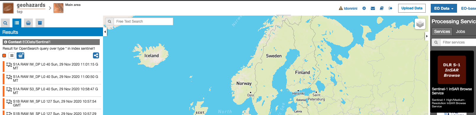
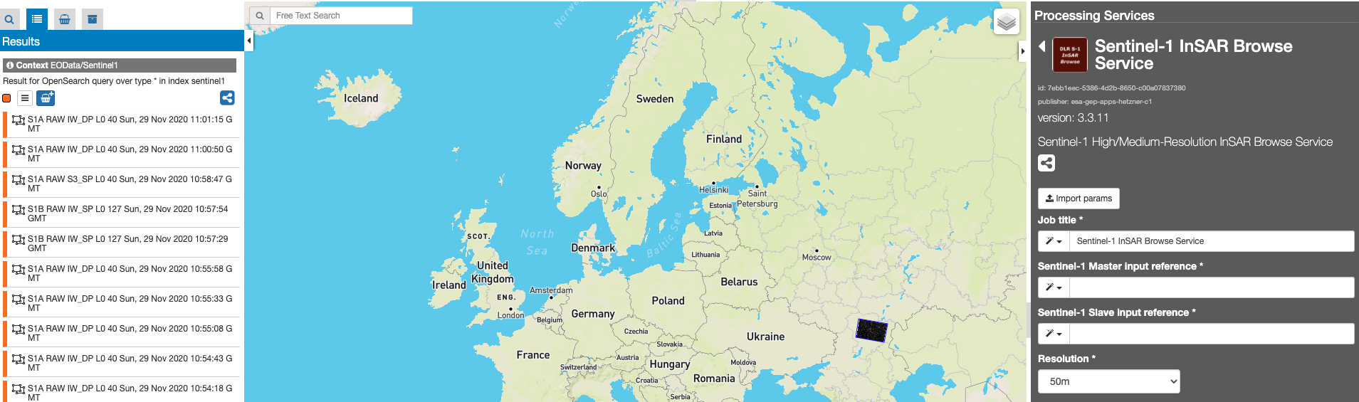
Select the processing
- Login to the platform (see user section)
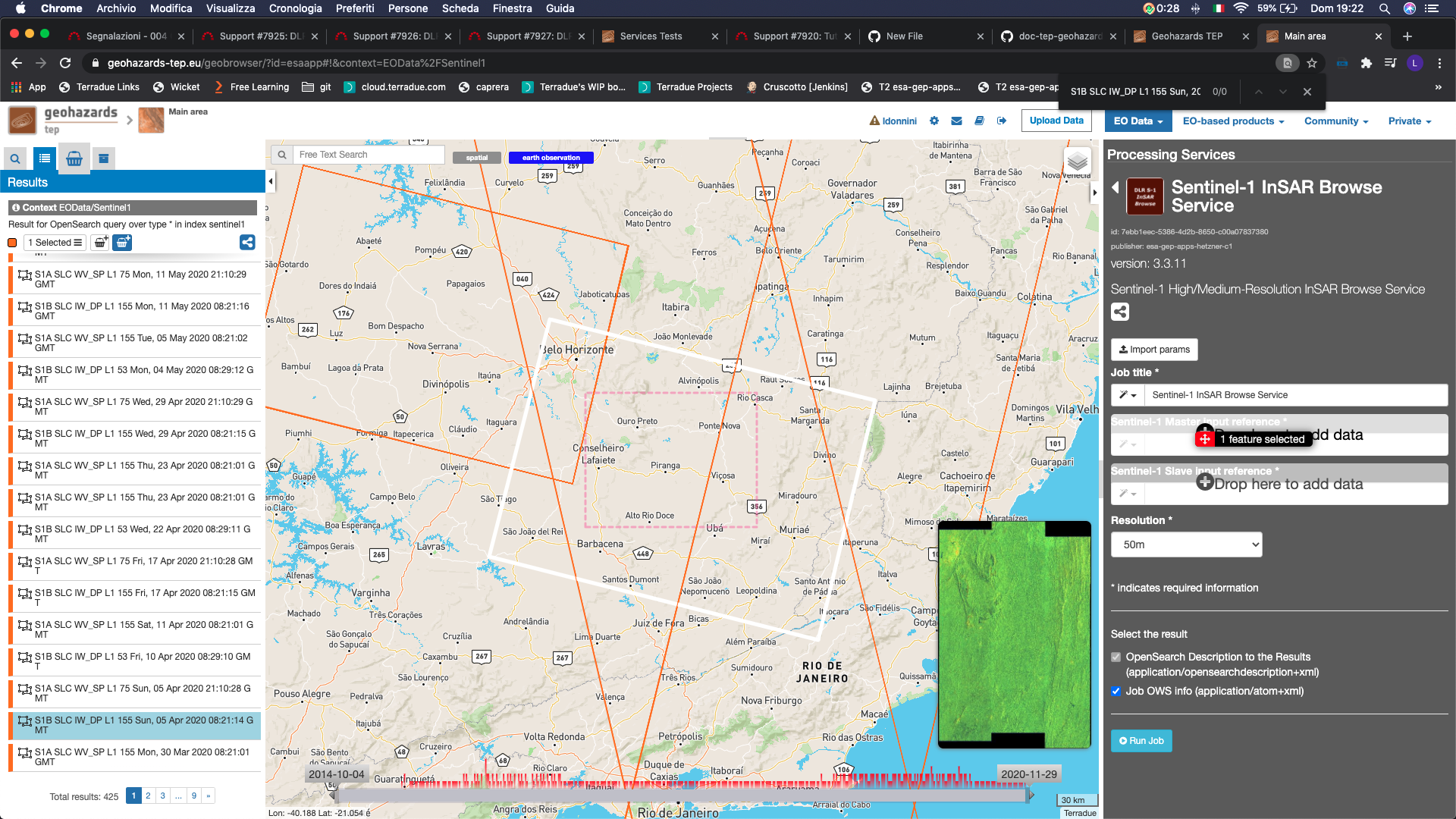
- Select the processing service “DLR Sentinel-1 InSAR Browse”:
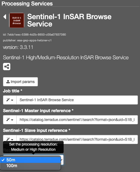
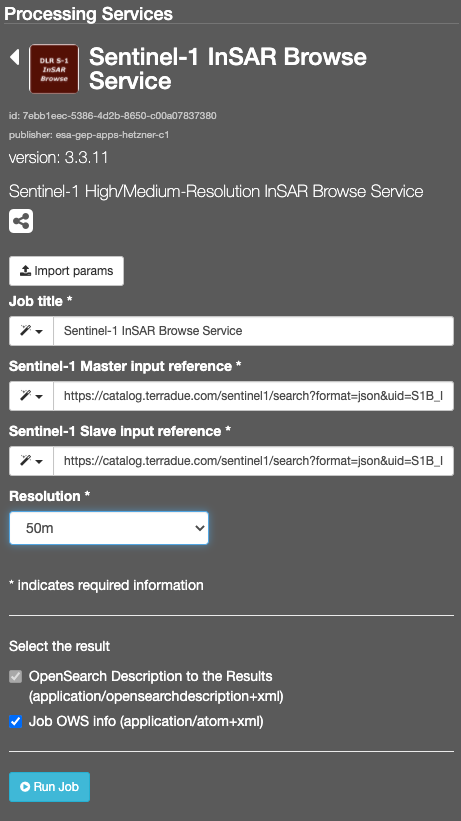
The “DLR Sentinel-1 InSAR Browse” panel is displayed with parameters values to be filled-in.
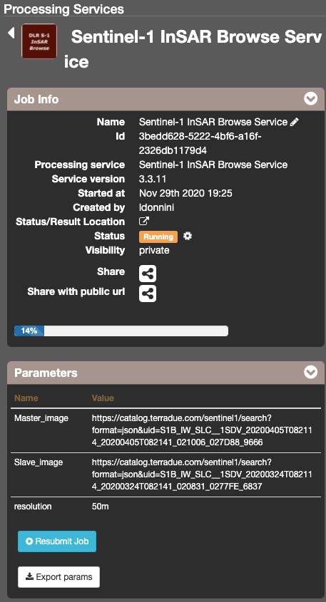
Run the job
- Click on the button Run Job and see the Running Job
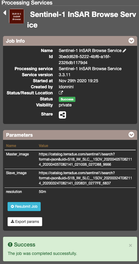
- After about 3 hours, see the Successful Job:
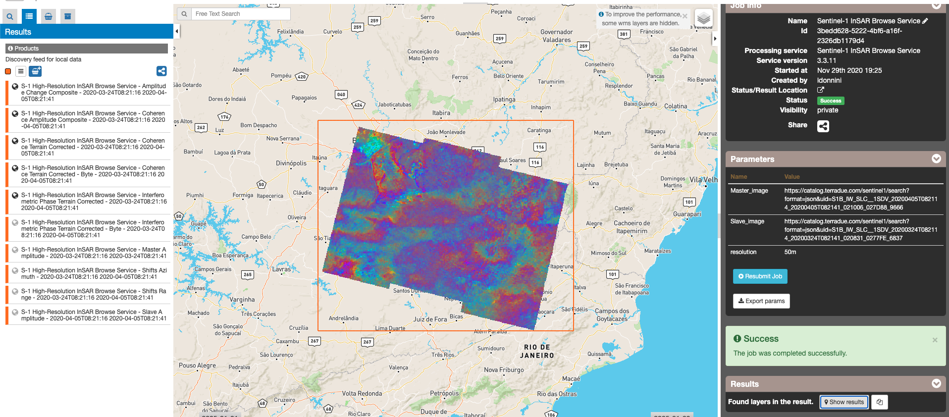
Results: download and visualization
- Click on the button Show results
- See the result on map: